Academy tutorial

How to Create Geospatial AR

Geospatial AR anchors digital content to a real-world place. This guide explains when to use it, how it differs from simpler location-based AR, and how to plan a Studio workflow that can survive field testing outside the office.

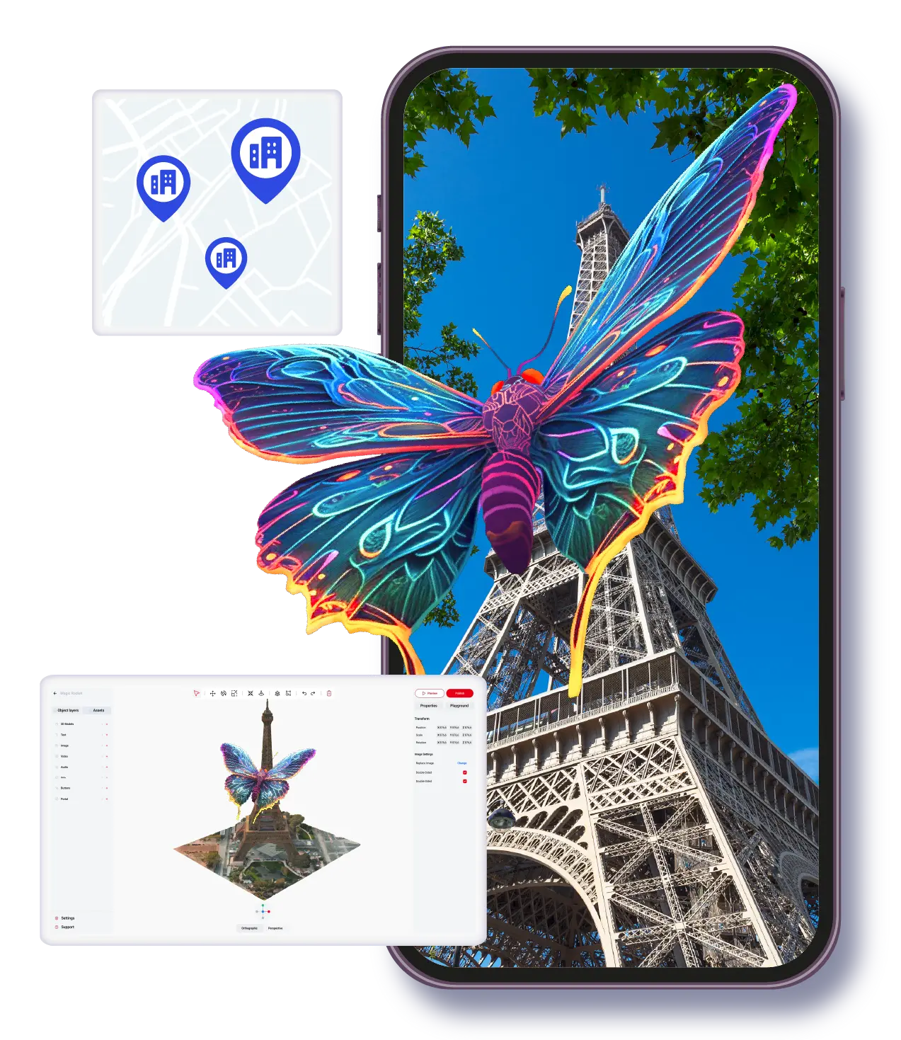
Geospatial AR experience in ARLOOPA Studio

Best for

Landmarks, city routes, museum grounds, outdoor events, and place-aware storytelling where the physical location is part of the content.

Watch out for

Field testing matters. Lighting, GPS conditions, device support, and the exact visitor path can all affect the result.

ARLOOPA fit

ARLOOPA Studio supports geospatial creation paths that help teams connect location, content, and publishing in one workflow.

Tutorials

Video tutorial for this workflow

Watch the matching Studio walkthrough before you build so the setup, asset choices, and publishing steps are easier to follow.

Creating Geospatial AR | ARLOOPA Studio Guide

Watch the current Academy guide for creating geospatial AR in ARLOOPA Studio.

Video summary

This Academy guide covers the geospatial AR creation flow in ARLOOPA Studio, including the provider choice and the project setup needed for place-aware experiences. It is most relevant for city tours, landmarks, museum routes, outdoor activations, and events where the physical location is part of the experience.

Definition

What geospatial AR is

Geospatial AR uses real-world position and environmental understanding to place content in a specific physical location. Instead of only asking a user to scan an image or tap a surface, the experience depends on where the user is standing and what place the project is built for.

This makes geospatial AR powerful for destinations, museums, parks, campuses, landmarks, exhibitions, and outdoor campaigns where the place itself carries meaning.

  • Use it when the location is part of the story.
  • Plan content around the visitor path, not just the 3D asset.
  • Test on site before treating the project as ready.

Format choice

When to use geospatial vs location-based AR

Location-based AR is useful when a broad GPS point or map-based trigger is enough. Geospatial AR is better when the content needs to feel anchored to a precise real place or when the environment needs stronger spatial context.

If the user only needs to arrive near a point and open content, location-based AR may be simpler. If the user should see content aligned to a landmark, route, building, plaza, or scanned location, geospatial AR is usually the stronger choice.

  • Choose location-based AR for broad map-triggered content.
  • Choose geospatial AR for place-aware alignment and stronger outdoor context.
  • Choose marker-based AR when a printed trigger is easier than field positioning.

Studio steps

Step-by-step geospatial creation flow

Start with the real site in mind. A geospatial project should not be designed only on a desktop because the final experience depends on how people move through the location.

After the place and provider path are chosen, add content conservatively, publish, and test on site under realistic conditions.

  1. 1Define the exact real-world place and visitor path.
  2. 2Open Studio and choose the geospatial AR creation flow.
  3. 3Choose the provider path that fits the project requirements.
  4. 4Add the 3D model, image, video, or other content that belongs at the place.
  5. 5Set the location or spatial reference according to the provider flow.
  6. 6Preview the setup and publish a test version.
  7. 7Go to the site and test with the devices and lighting users will have.
  8. 8Adjust placement, asset scale, and instructions before the public launch.

Testing

Field testing tips before launch

A geospatial AR experience should be tested where it will be used. Test from the expected arrival point, in different lighting, and on more than one supported device. Watch for moments where users are unsure where to stand, where to point the phone, or what to do next.

Good field testing is usually less about proving the effect works once and more about finding the weak moments in the visitor journey.

  • Test outdoors at the same time of day as the expected audience visit.
  • Check the first instruction users see before content appears.
  • Keep content readable at walking distance and in bright light.
  • Avoid launching with only one successful internal test.

Use cases

Tourism, city, museum, and event use cases

Geospatial AR is a strong fit for place-based storytelling. A city can add historical scenes to landmarks, a museum can guide visitors through outdoor exhibits, a tourism team can create destination routes, and an event team can place sponsor content or scavenger-hunt objects around a venue.

The common thread is that the content should belong to the place. If the location does not matter, another AR format may be simpler and easier to maintain.

  • Tourism: landmark stories, city walks, destination previews, and visitor routes.
  • Museums: outdoor interpretation, heritage trails, and exhibition navigation.
  • Events: sponsor activations, venue waypoints, and scavenger hunts.
  • Cities and campuses: public art, orientation, and educational overlays.

FAQ

How to Create Geospatial AR FAQ

What is geospatial AR?

Geospatial AR places digital content in relation to a real-world location so the experience depends on where the user is and how the place is recognized.

How is geospatial AR different from location-based AR?

Location-based AR can use broad map or GPS triggers, while geospatial AR is better for content that needs stronger alignment to a real-world place.

Do I need to test geospatial AR on site?

Yes. Field testing is essential because the final result depends on the real location, device behavior, lighting, and visitor path.

What industries use geospatial AR?

Tourism, museums, city storytelling, campuses, live events, exhibitions, and outdoor brand activations are common fits.

Can geospatial AR use 3D models?

Yes. 3D models can be part of a geospatial experience, but they should be optimized and scaled for the real place where users will see them.

Next step

Build a geospatial AR experience

Use ARLOOPA Studio to plan the place, content, and field testing path before you launch a public geospatial project.

Existing Studio pages

Related Solutions

Use these established Studio pages when you need deeper solution or industry detail beyond this guide.

Continue reading

Related Reading

These supporting guides answer the next practical questions readers usually have before launching an AR project.


ARLOOPA Inc. 2026